
| ||
| Return to Table of Contents Go to Page [1] [2] [3] [4] [5] [6] [7] [8] [9] [10] [11] [12] [13] [14] [15] [16] [17] [18] [19] [20] [21] [22] [23] [24] [25] [26] [27] [28] [29] [30] [31] [32] [33] [34] [35] [36] [37] [38] [39] [40] [41] [42] [43] [44] [45] [46] [47] [48] [49] [50] [51] | ||
PAGE 30
| Plan of the riverfront of the Faubourg Ste.
Marie by Mansuy-Pellitier, 1807. This plan rather dramatically illustrates the extent of the batture, the land
that the river deposited in front of the levee. The plan includes a note asserting that the batture was to be
used for the public benefit of the city of New Orleans, a claim that was disputed by Edward Livingston in a
series of court cases running from 1806 well into the 1820s. | [Louisiana Map Collection, MaM 807/4; MS42] 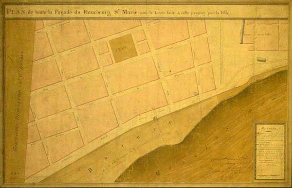
|