
| ||||||
| Return to Table of Contents Go to Page [1] [2] [3] [4] [5] [6] [7] [8] [9] [10] [11] [12] [13] [14] [15] [16] [17] [18] [19] [20] [21] [22] [23] [24] [25] [26] [27] [28] [29] [30] [31] [32] [33] [34] [35] [36] [37] [38] [39] [40] [41] [42] [43] [44] [45] [46] [47] [48] [49] [50] [51] | ||||||
PAGE 25
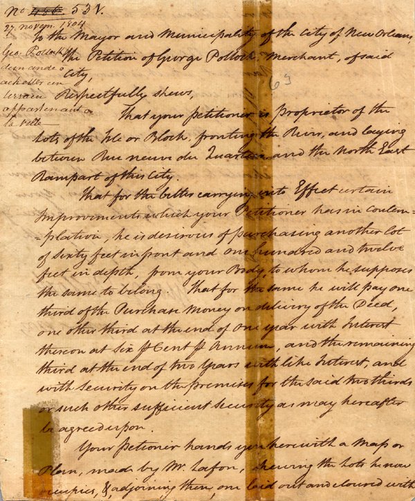
| The November 28, 1804 session of the
Conseil Municipal includes a reference to a communication from George Pollock, who asked to purchase a
lot owned by the city adjoining his property fronting on the river and laying between Rue Neuve du Quartier
(now Barracks Street) and the Northeast Rampart of the city.
|
Accompanying Pollock's request was a map by the surveyor Barthélémy Lafon showing the
property Pollock owned and the lot he wished to purchase. The map itself is more interesting than Pollock's
petition to purchase his lot, since it shows the location of the old military barracks ("casernes") in the
large
square which also housed Ursuline convent and the Royal Hospital (neither of which appear on the map).
John McDonogh, who bought the barracks and the land surrounding them in 1821, described the larger of
the two buildings as "of great extent and of brick, it is 56 feet in width, by 225 feet in length,--and its height,
equals that of a three story house—it is capable of lodging 2000 men . . . " By the late 1830's, Chartres
Street and Hospital Street were cut through the large square, the Ursulines relocated to a new convent on
the Industrial Canal, the barracks were demolished (in 1838), the troops moved to Jackson Barracks, and
the square was subdivided and sold to individual owners. Next page of this document
| 
| ||||