
|
| Page Three
Click on the thumbnail image to see a larger version. Use your browser's BACK button to return to the introduction |
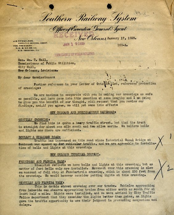
| This three-page letter from the Southern Railway System details
measures taken by the company to make its railroad crossings safer for New Orleanians.
[Department of Utilities Records] |

The railroads serving New Orleans have been one of the
principal factors contributing to its development and growth. The strategic
location of New Orleans on the Gulf Coast as the gateway to the Mississippi
Valley has made it the terminus for seven great railway systems, as well as the
second port of the nation. In addition to the trunk lines, there is the
municipally owned Public Belt Railroad, which was built principally to provide
switching services to the Port. All trunk lines entering New Orleans terminate
here-none operates through the city. Practically no through-car passenger
service is operated. Since industrial development is only a fraction of that of
equal-sized Northern and Eastern cities, most of the great volume of freight
entering the Port is shipped directly inland. The key location of New Orleans
as a principal terminal for railway systems radiating north, west, and east, and
the relatively small industrial development of the city combined, result in an
unusually large proportion of the freight brought into the city being
interchanged between the carriers.
[Godat and Heft, Report on Proposed Railroad Grade Crossing
Elimination and Terminal Improvement for New Orleans, Louisiana (1944), v. 1, p.
1] | |
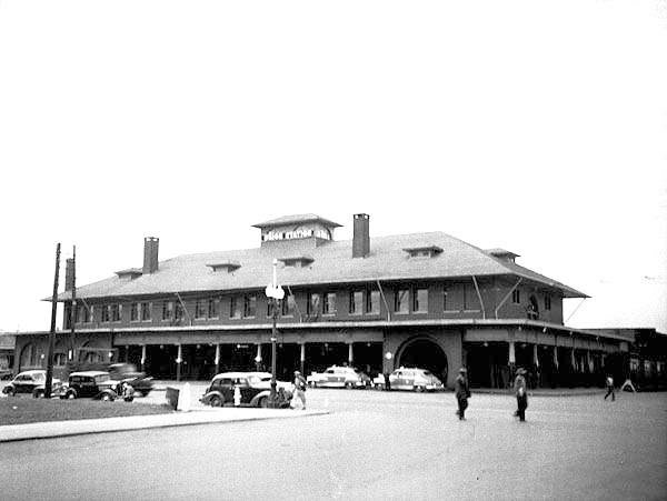
| Union Station in the 1940s. The building itself was the only railroad
station designed by famed Chicago architect Louis Sullivan. At the beginning of his career, Frank Lloyd
Wright worked in Sullivan's offices and contributed to the design of the station.
[Photo by Arthur W. Tong. New Orleans Railroad Terminal Board Series, Municipal Government Photograph Collection] |
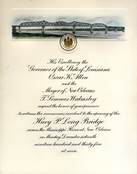
| Invitation to the grand opening of the Huey P. Long Bridge.
[Rare Vertical File] |
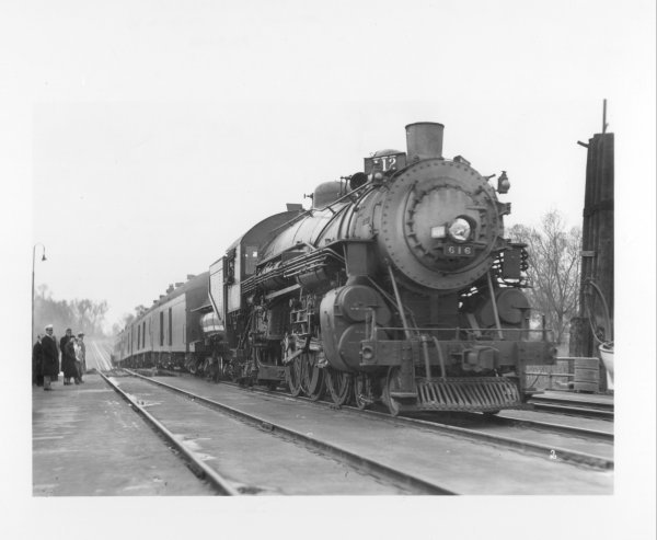
|
The first train to cross the Public Belt Railroad's new Huey P. Long Bridge, December 16, 1935. The was
one of the Southern Pacific's largest freight engines, piloted by Stanley L. Barras and Thomas G. Hebert,
veterans of the SP line. The opening of the bridge was celebrated with elaborate ceremonies, including a
historical transportation pageant that preceded the trains over the bridge: boy scouts dressed as Native
Americans, colonial horsemen and mounted guards, a pioneer stage coach, a primitive locomotive, a
"horseless carriage," and modern automobiles. Once the first train had crossed the span, an excursion train
carrying nearly 1000 people left Union Station for a trip to Avondale and back. Regular train service on the
bridge began on December 17 - and continues today.
[Charles Franck Photograph Collection] |
Conspicuous among the agencies contributing to the
commercial development and expansion of New Orleans are traffic facilities
afforded by the industrial switch track. This branch of steam railroad service
now skirts practically the entire east bank river front of the City, between the
dividing lines of the Parishes of St. Bernard and Jefferson, a distance of
approximately twelve miles-not to mention immense inland facilities controlled
by trunk lines entering New Orleans and those of the local Public Belt Railroad
Commission, operating the "Public Belt," the only municipally owned railroad of
its kind in the United States.
[Reference-Digest of Industrial Switch Track Ordinances
(1921), p. 3] | |
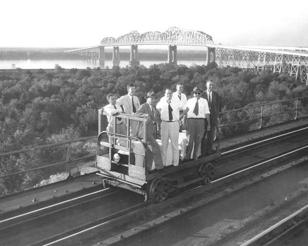
|
Mayor deLesseps S. Morrison and others ride in style on the Public Belt tracks with the Huey P. in the
background.
[New Orleans Public Belt Railroad Series, Municipal Government Photograph Collection] |
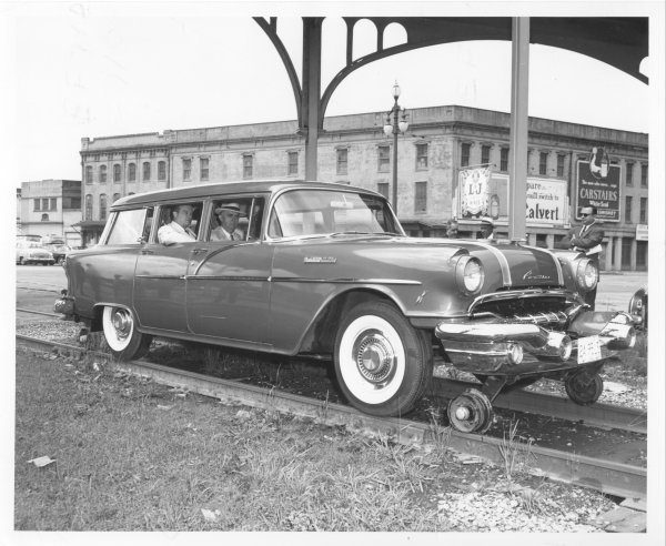
|
Public Belt Railroad officials and employees rode the rails in this specially fitted car/train.
[New Orleans Public Belt Railroad Series, Municipal Government Photograph Collection] |
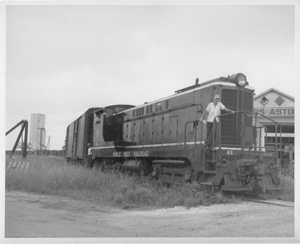
|
One of the Public Belt Railroad's engines. The Public Belt's trains provide switching and haulage service,
on a non-profit basis, to railroads serving the New Orleans area.
Photograph by Photography Unlimited. New Orleans Public Belt Railroad Series, Municipal Government Photograph Collection] |
| This watercolor of the L&N Station was painted by Works Progress
Administration artist Amelia Geiger in 1939.
[Works Progress Administration Photograph Collection] |
The facilities and operations of the railroads at New
Orleans, particularly those which affect vehicular traffic and passenger
service, are basically little different than they were nearly thirty years ago,
except for changes effected by the completion of the Public Belt Mississippi
River Bridge in 1935. Meanwhile, the city and its vehicular traffic have grown
enormously, and railroad facilities and operations now materially interfere with
the orderly flow of vehicular traffic and are also factors impeding the logical
physical development of the city. Study immediately discloses that belt routes,
interchange locations, grade crossing elimination and improvement of passenger
and freight terminals are so inter-related that a sound program for improvement
of railroad facilities must include consideration of all these factors. Because
of the conflicting interests involved, accomplishment of the long-needed
improvements has not been effected.
[Godat and Heft, Report on Proposed Railroad Grade
Crossing Elimination and Terminal Improvement for New Orleans, Louisiana (1944),
v. 1, p. 1] | |
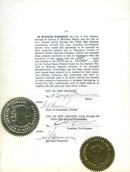
| The first of seventeen pages of signatures to the agreement between
the City of New Orleans and the railroads for the construction of the Union Passenger Terminal.
[Department of Utilities Records] |
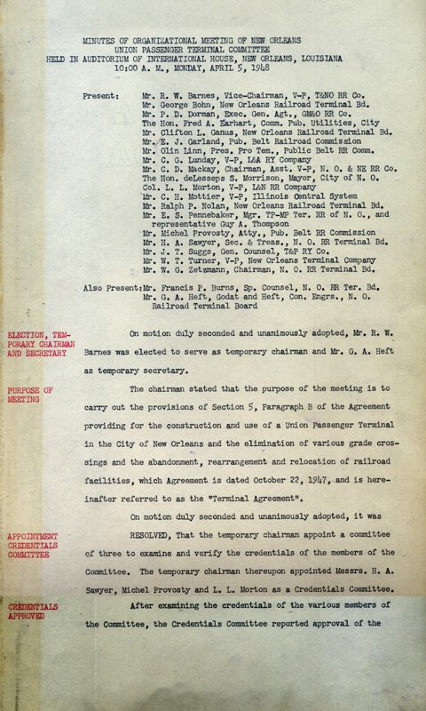
| The Union Passenger Terminal Committee implemented the UPT
agreement. Shown here is page one of Committee's first meeting as documented in that body's official
minute book.
[Union Passenger Terminal Committee Records] |
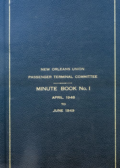
| The cover of the UPT Committee's first minute book.
[Union Passenger Terminal Committee Records] |
The Illinois Central Railroad, which was incorporated in
1851, connects New Orleans with Chicago and the Mid-Continent Area. Through a
combination of rail and water facilities, service between Chicago and New
Orleans was begun in 1858. And, in 1882, the Illinois Central acquired the
Yazoo and Mississippi Valley Railroad, connecting New Orleans with Memphis, via
Baton Rouge, Vicksburg and Greenville. By 1883, the Illinois Central had
established a continuous all-rail service between New Orleans and Chicago, via
Jackson, Mississippi, Memphis, and Cairo. The Illinois Central, which owns and
operates the Stuyvesant Docks, provides employment for more than 2,000 men and
women at New Orleans.
[New Orleans Union Passenger Terminal Dedication Program,
Saturday, May 1, 1954] | |
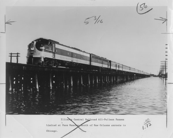
|
The Illinois Central's Panama Limited at Pass Manchac north of New Orleans enroute to Chicago. In 1912,
the IC renamed its New Orleans to Chicago route in honor of the opening of the Panama Canal. A few
years later, the Panama Limited became an all-Pullman train - the luxury night train to Chicago. With a brief
hiatus during the Depression, the Panama continued to provide Chicago-New Orleans service (along with its
sister train, the day time coach train The City of New Orleans) until the late 1960s, when night service
was discontinued.
[Photograph by Richard Dixon. General Interest Photograph Collection] |
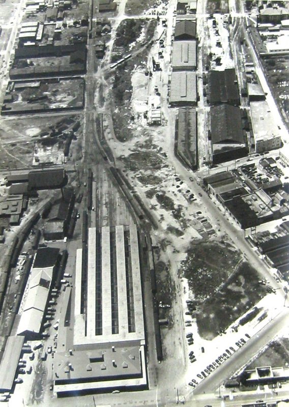
|
This aerial photograph, taken ca. 1949, shows Union Station with the newly filled in New Basin Canal on the
right.
[Large Aerial Photograph Collection] |
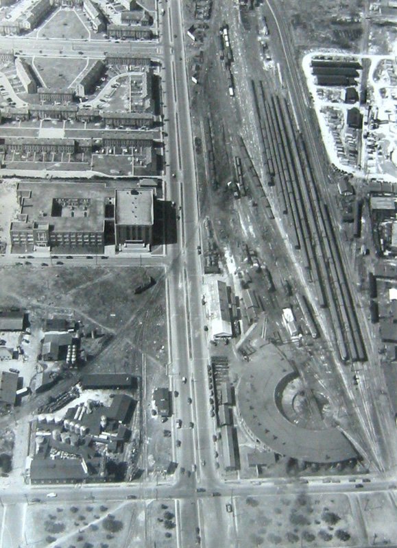
|
The Illinois Central roundhouse on Earhart Boulevard, ca. 1949. Across the street is Booker T. Washington
High School and the Calliope (B.W. Cooper) Housing Project. Today, the roundhouse is gone and the site
is occupied by Amtrak's coach yard and Pullman building.
[Large Aerial Photograph Collection] |
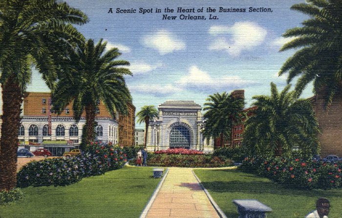
| This postcard of Elk Place, with the Southern station at the end, across
Canal Street dates from the 1950s.
[Louisiana Postcard Collection] |
| Title Page ||| Introduction ||| Page 1 ||| Page 2 ||| Page 3 ||| Page 4 |