| New Orleans Incorporated: 200 Years of the City Charter Louisiana Division | New Orleans Public Library p a g e 11 |
| n e x t . c o n t e n t s |
|
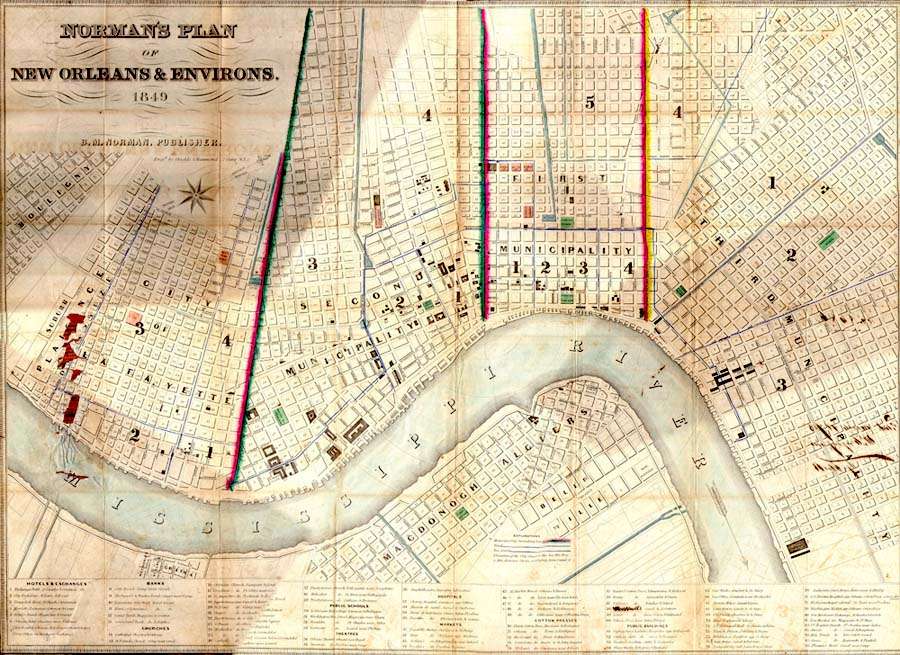
B. M. Norman’s 1849 map of New Orleans delineates the boundaries of the three municipalities into which the city was divided by the 1836 Charter. The neighboring city of Lafayette, also shown on the Norman map, would soon come to play an important part in the history of the Crescent City.
[Louisiana Map Collection]
|
|
|